Tongue Mountain
Follow this short-but-steep route up to the site of a long-gone fire lookout, beginning in lush forest and ending on a barren precipice. Along the way pass a wide variety of wildflowers that thrive in these diverse environments.
Total Distance: 3.0 miles
Total Ascent: 1000ft
Highest Point: 4600ft
Total Ascent: 1000ft
Highest Point: 4600ft
Difficulty: Moderate
Our Hiking Time: 1h 30m
Required Permit: None
Our Hiking Time: 1h 30m
Required Permit: None
From Randle, take State Route 131 south for 1.0 mile to Forest Road 23 (Cispus Road), veering left toward Cispus Center and Trout Lake. Continue on FR 23 for 8.1 miles to signed Cispus Road (FR 28), taking a left toward the Cispus Learning Center. Continue 0.9 mile to FR 29, veering left toward the Boundary Trail No. 1 and leaving the pavement. Continue 3.8 miles to FR 2904. Turn left and follow FR 2904 for 4.0 miles to the trailhead on the left side of the road. View Google Directions >>
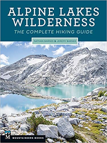
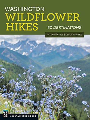
From the trailhead, the Tongue Mountain Trail #294 begins along a wide tire-gouged track leading through young forest. The first section of the hike undulates over small hummocks for nearly a mile, past slender trunks of lichen-covered hemlocks and fir surrounded by a dense understory of vine maple. Find water loving blooms crowding the trail along this stretch, thriving in small patches between the ferns. There's a lot more to Tongue Mountain, and you can learn all about it in Washington Wildflower Hikes: 50 Destinations. You'll find a trail map, route descriptions, history, and more for this and many other hikes throughout the State. Help support hikingwithmybrother.com and the work we do by picking up a copy!
Nearby hikes
- None
Similar Difficulty
Similar Features